
Winterslow
Guida di viaggio

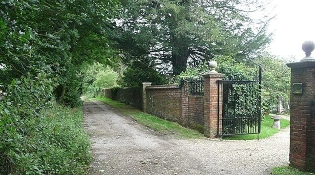


Winterslow da scoprire

Leonardo Hotel Southampton
1 Charlotte Place Southampton England
Il prezzo è 86 € a notte nel periodo 19 lug - 20 lug
86 €
19 lug - 20 lug
tasse e oneri inclusi
Alloggia in questo hotel per viaggi d'affari a Southampton. Potrai approfittare di utili servizi come il Wi-Fi gratuito, la colazione (a pagamento) e il servizio ...
8,6/10 Eccellente! (1379 recensioni)
"Letti e cuscini comodi e spaziosi. Personale disponibile"
Recensione del 4 mar 2024

Moxy Southampton
Harbour Parade Southampton England
Il prezzo è 123 € a notte nel periodo 19 lug - 20 lug
123 €
19 lug - 20 lug
tasse e oneri inclusi
Alloggia in questo hotel per viaggi d'affari a Southampton. Potrai approfittare di utili servizi come il Wi-Fi gratuito, la colazione (a pagamento) e una reception ...
9/10 Fantastico! (1029 recensioni)
"The staff at the Moxy were helpful and kind. The location of the hotel is great for being able to explore Southampton and access a variety of entertainment and dining options."
Recensione del 16 lug 2026

Leonardo Royal Southampton Grand Harbour
West Quay Road Southampton England
Il prezzo è 129 € a notte nel periodo 19 lug - 20 lug
129 €
19 lug - 20 lug
tasse e oneri inclusi
Alloggia in questo hotel con spa a Southampton. Potrai approfittare di utili servizi come il Wi-Fi gratuito, una spa completamente attrezzata e la colazione ...
8,6/10 Eccellente! (1794 recensioni)
"Albergo bellissimo , sembrava di vivere in un luogo antico , hanno un bellissimo ristorante su un parco che affaccia direttamente sulle antiche mura , attraverso la strada e ti godi il fascino delle mura antiche con la loro nave antica . C’è un bar che affaccia direttamente su questo parco e il camino ..."
Recensione del 28 giu 2026
Prezzo per notte più basso trovato nelle ultime 24 ore, per un soggiorno di 1 notte per 2 adulti. Tariffe e disponibilità sono soggette a modifica. Si applicano condizioni aggiuntive.

room2 Southampton Hometel
1 Queen's Terrace Southampton England
Soggiorna in questo aparthotel a Southampton. Potrai approfittare di utili servizi come il Wi-Fi gratuito, la colazione (a pagamento) e una palestra. Nelle recensioni, ...
9,4/10 Eccezionale! (1260 recensioni)
"Cozy room, very comfortable bed. Excellent stay"
Recensione del 22 nov 2025

QE2 Loft Apartments
High St Southampton England
Soggiorna in questo appartamento a Southampton. Potrai approfittare di utili servizi come il Wi-Fi gratuito, un servizio lavanderia e lavatrici/asciugatrici ...
5,6/10 (5 recensioni)
"The apartment was beautifully decorated and very comfortable bed but as we stayed during a heatwave the fan provided was not adequate so the room was constantly 31-32 degrees. The room really needs air conditioning. The restaurant below had very loud live music playing directly below our windows, ..."
Recensione del 12 lug 2026

Romantic Swiss Cabin Hideaway & Hot Tub Spa Pool
Chandler's Ford England
Soggiorna in questa baita a Eastleigh. Potrai approfittare di utili servizi come la prima colazione inclusa nel prezzo, il Wi-Fi gratuito e piscine private. ...
5/10 (2 recensioni)
"Lovely host and a cute, cosy cabin. The only downside was that it felt more overlooked than we expected, as it's essentially within the host's garden, so there wasn't as much privacy as we'd hoped. Also, be aware that use of the jacuzzi costs an additional 25, which we only found out after booking ..."
Recensione del 3 lug 2026
Prezzo per notte più basso trovato nelle ultime 24 ore, per un soggiorno di 1 notte per 2 adulti. Tariffe e disponibilità sono soggette a modifica. Si applicano condizioni aggiuntive.
Cose da fare
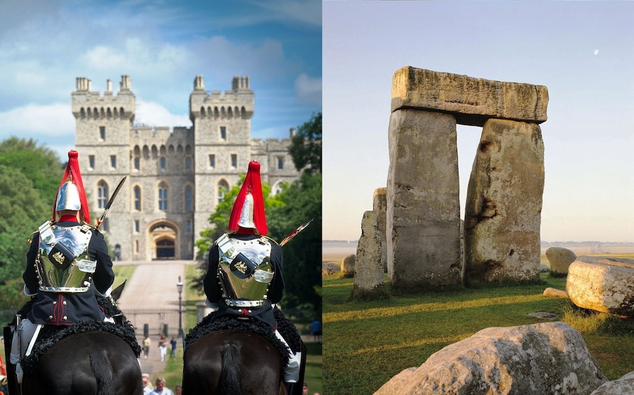
Tour di un giorno del Castello di Windsor, Stonehenge e Bath con guida esperta
83 €
per adulto
90% dei viaggiatori consiglia questa attività
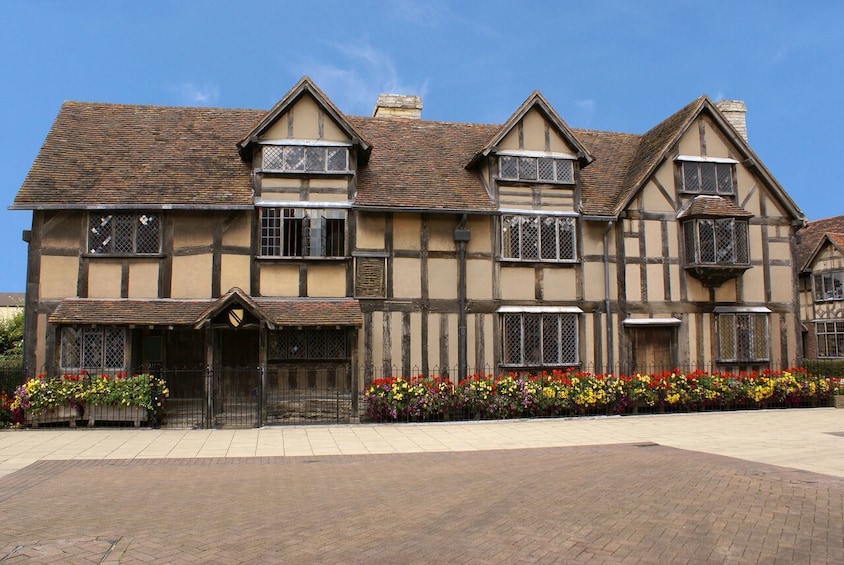
Inghilterra in 1 giorno: Stonehenge, Bath, Stratford-upon-Avon e delle Cotswolds
108 €
per adulto
86% dei viaggiatori consiglia questa attività

Da Birmingham Tour di un giorno a Stonehenge e Bath
93 €
per adulto

Visita privata all'alba o al tramonto di Stonehenge con Bath e Lacock
192 €
per adulto
94% dei viaggiatori consiglia questa attività

Stonehenge e i villaggi del Cotswold da Bristol
123 €
per adulto
96% dei viaggiatori consiglia questa attività

Tour di Stonehenge da Southampton a Londra
159 €
per adulto
98% dei viaggiatori consiglia questa attività


- Terminal per le crociere di Southampton
- Parco Nazionale New Forest National Park
- Stonehenge
- Parco Tematico Paultons Park - Home of Peppa Pig World
- Castello di Highclere
- Salisbury Cathedral
- South Downs National Park
- Winchester Cathedral
- Ocean Village Marina
- Università di Southampton
- Mayflower Theatre
- Marwell Zoo
- St. Mary's Stadium
- Wilton House
- New Forest Wildlife Park
- Mayflower Park
- Old Sarum
- SeaCity Museum
- Distilleria Bombay Sapphire Distillery
- Kennet & Avon Canal
- Winchester Science Centre & Planetarium
- Tudor House & Garden
- Southampton Solent University

