

Campeggi a Alton
 Non preoccuparti se cambi ideaScegli un hotel con cancellazione gratuita.
 Concediti un viaggio specialeAccedi al tuo account e risparmia il 10% o più su migliaia di hotel.
 Trova l’alloggio che fa per teCerca fra un milione di strutture in tutto il mondo.
Controlla i prezzi per queste date
Tra due settimane
Tra due mesi
Tra tre mesi
Tra quattro mesi
I nostri consigli per i migliori campeggi per camper in questa destinazione: Alton
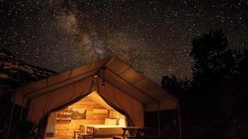

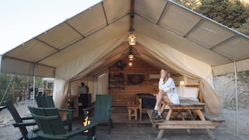
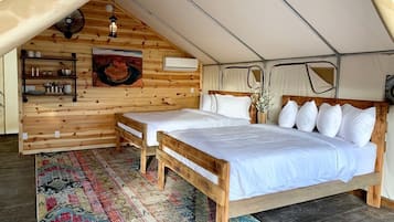
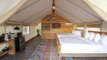
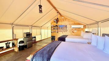
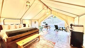
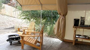
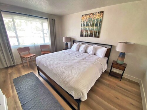
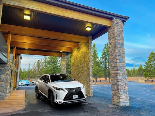
Glamping Tent # 7 presso East Zion Resort (Two Queen Beds)
Glamping Tent # 7 presso East Zion Resort (Two Queen Beds)Orderville
10.0 su 10, Eccezionale, (4 recensioni)
“Excellent location to stay near Zion National Park. The coffee shop near by is amazing! ”

Christina
Il prezzo attuale è 268 €
tasse e oneri inclusi
5 lug - 6 lug


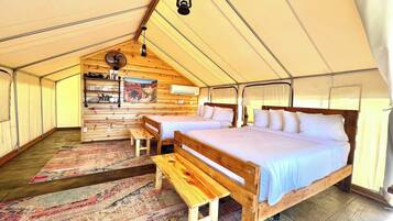
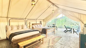
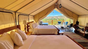
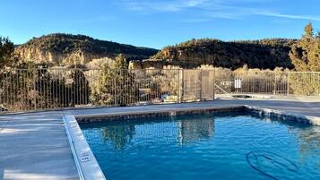
Tenda n. 1 all'East Zion Resort (2 letti queen size)
Tenda n. 1 all'East Zion Resort (2 letti queen size)Orderville
10.0 su 10, Eccezionale, (6 recensioni)
“Stayed with two grandkids and had a great time. Perfect location, nice property with wonderful pool.”
Allan C.
Il prezzo attuale è 285 €
tasse e oneri inclusi
30 lug - 31 lug

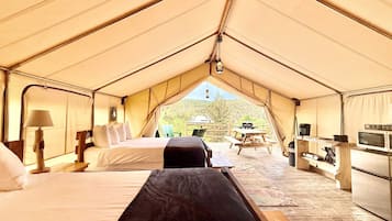
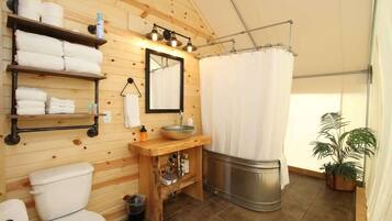
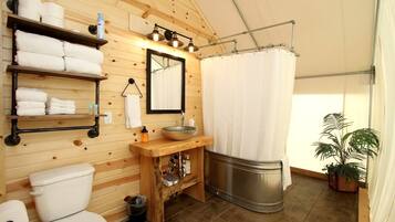
Glamping Tent # 2 presso East Zion Resort (Two Queen Beds)
Glamping Tent # 2 presso East Zion Resort (Two Queen Beds)Orderville
9.8 su 10, Eccezionale, (10 recensioni)
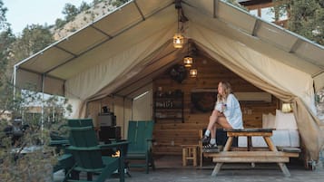
“Such a great time! Tent was very clean and very well decorated! The only downside was no locks on the door, however we felt very safe. Very small town but larger towns within distance. Archie’s food truck next door was so good and fun! Staff was fabulous with check in and check out , and questions! Really enjoyed. UTV tour was also right next door at Roam and was amazing! ”
Kathryn H.
Il prezzo attuale è 258 €
tasse e oneri inclusi
6 lug - 7 lug
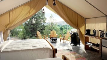

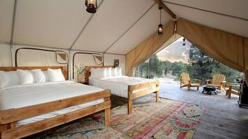
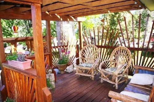
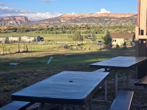
Luxury Camping Rental near Zion Nation Park for Utah Glamping
Luxury Camping Rental near Zion Nation Park for Utah GlampingOrderville

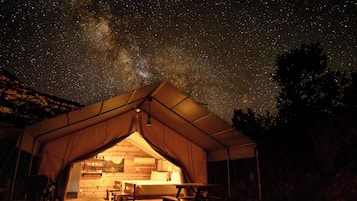
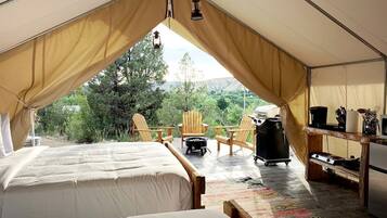
Glamping Tent # 8 presso East Zion Resort (Two Queen Beds)
Glamping Tent # 8 presso East Zion Resort (Two Queen Beds)Orderville
10.0 su 10, Eccezionale, (1 recensione)
“Nice stay in a quiet and friendly glamping resort. The pool and hot tub amenities were excellent and we were able to make use of them. However, if you are looking for a place that is totally isolated and free from light pollution this is not the place. The reason I chose this experience was to look at the stars and while some could be seen the proximity to the highway obstructed this . Overall the accommodations were clean and matched exactly to the description. However there was no security at...
Giovanna B.

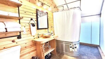
Glamping Tent # 4 presso East Zion Resort (Two Queen Beds)
Glamping Tent # 4 presso East Zion Resort (Two Queen Beds)Orderville
9.0 su 10, Meraviglioso, (4 recensioni)
“Wir hatten ein Zelt im East Zion Resort gebucht.
Das Zelt war sauber und super ausgestattet. Auch der Kontakt mit dem Besitzer verlief freundlich und hilfsbereit.
Der obere Pool war super schön. Allerdings ist das Resort öffentlich zugänglich. Das heißt, dass jeder in die Zelte kann, da man diese nicht verschließen kann, weshalb ich mich unsicher gefühlt habe.
Gegen Abend wollten wir noch in den Pool was leider nicht möglich war. Es standen mindestens 6 Autos davor und der Pool war bereits...

Nicole


Glamping Tent # 10 presso East Zion Resort
Glamping Tent # 10 presso East Zion ResortOrderville
10.0 su 10, Eccezionale, (4 recensioni)
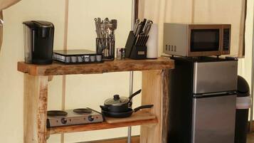
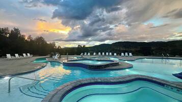
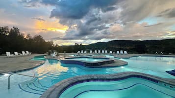
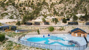
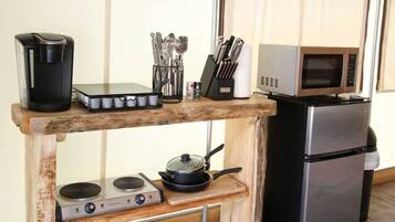
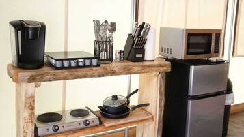
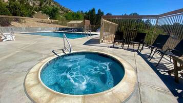
“The hospitality of this resort is outstanding! They thought of EVERY comfort in what was provided in our glamping tent, including heat or air conditioning, as well as stocked supplies, utensils and cookware. The resort is incredibly creative with the variety of lodging choices and two separate pools to enjoy, plus a laundry facility that we were glad to use. Thoughtful touches such as flickering solar lighting all around created a dreamy vibe, along with the gas fire pits and Adirondack chairs...
Bradley C.
Il prezzo attuale è 317 €
tasse e oneri inclusi
7 lug - 8 lug

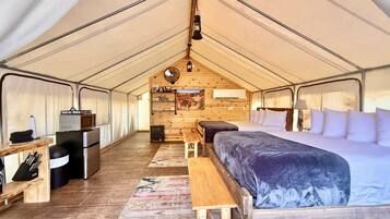
Glamping Tent # 3 presso East Zion Resort (King Suite)
Glamping Tent # 3 presso East Zion Resort (King Suite)Orderville
Il prezzo attuale è 281 €
tasse e oneri inclusi
3 ago - 4 ago


Prezzo a notte più basso trovato nelle ultime 24 ore, per un soggiorno di 1 notte per 2 adulti. Prezzi e disponibilità possono cambiare. Potrebbero essere previste condizioni aggiuntive.
Trova le case vacanza più adatte al tuo stile
Baite
Aparthotel

Accedi al tuo account e risparmia in media un 15% su migliaia di hotel
Migliori recensioni hotel nei pressi di Alton

Mountain Ridge Cabins and Lodging
10/10 Eccellente


Altre informazioni su Alton
Campeggi: Alton
Numero di recensioni degli ospiti | 7.590 |
|---|---|
Numero di strutture | 728 |
Prezzo più basso | 49 € |
Prezzo più alto | 521 € |
Domande frequenti
Scopri un mondo di viaggi con Expedia
- Brian Head: Baite
- Southwestern Utah - Bryce Canyon: Ville
- Southwestern Utah - Bryce Canyon: Case private in affitto
- Southwestern Utah - Bryce Canyon: Ranch
- Hurricane: B&B
- Mount Carmel: hotel
- Brian Head: hotel
- Bryce Canyon: hotel
- Kanab: hotel
- Bryce Canyon: hotel nelle vicinanze
- Glendale: hotel
- Duck Creek Village: hotel
- Cannonville: hotel
- Tropic: hotel
- Alton: hotel
- Panguitch: hotel
- Orderville: hotel
- Hatch: hotel
- Parco Nazionale di Bryce Canyon: hotel nelle vicinanze
- Springdale: hotel
- Zion National Park East Entrance: hotel nelle vicinanze
- Southwestern Utah - Bryce Canyon: Hotel di lusso
- Bryce Canyon: Hotel di lusso
- Southwestern Utah - Bryce Canyon: hotel Motel 6
- Voli in partenza da qui: Bryce Canyon
- Voli per Glendale
- Voli per Bryce Canyon
- Voli per Brian Head
- Voli da Tutti gli aeroporti di New York (NYC) a Bryce Canyon (BCE)
- Voli da San Diego (SAN) a Bryce Canyon (BCE)
- Voli da Los Angeles (LAX) a Bryce Canyon (BCE)
- Voli da Orlando (MCO) a Bryce Canyon (BCE)
- Voli da Nashville (BNA) a Bryce Canyon (BCE)
- Voli da San Francisco (SFO) a Bryce Canyon (BCE)
- Voli da Columbus (CMH) a Bryce Canyon (BCE)
- Voli da Las Vegas (LAS) a Bryce Canyon (BCE)
- Voli da Denver (APA) a Bryce Canyon (BCE)
- Voli da Chicago (ORD) a Bryce Canyon (BCE)
- Voli da Cedar City (CDC) a Bryce Canyon (BCE)
- Voli da Dallas (DFW) a Bryce Canyon (BCE)
- Voli da Melbourne (MEL) a Bryce Canyon (BCE)
- Voli da Polacca (PXL) a Bryce Canyon (BCE)
- Voli da Salt Lake City (SLC) a Bryce Canyon (BCE)
- Voli da New York (JFK) a Bryce Canyon (BCE)
- Voli da Bryce Canyon
- Voli da Springdale
- Voli da Hatch
- Visita Bryce Canyon
- Visita Hatch
- Visita Panguitch
- Visita Mount Carmel
- Visita Orderville
- Visita Springdale
- Visita Duck Creek Village
- Visita Tropic
- Visita Paria
- Visita Southwestern Utah - Bryce Canyon
- Visita Glendale
- Visita Alton
- Visita Kanab
- Visita Brian Head
- Vacanze a Bryce Canyon
- Parco Statale Coral Pink Sand Dunes
- Peek-A-Boo Canyon
- Red Canyon
- Inspiration Point
- Zion Canyon Visitor Center
- Checkerboard Mesa
- Weeping Rock Trail
- Parco Nazionale di Bryce Canyon
- Mossy Cave Trail
- Centro Commerciale Old Bryce Town
- The Narrows
- Old Paria
- Tempio di Sinawava
- Thunder Mountain Motorsports
- The Grotto Picnic Area
- Clear Creek Overlook
- Moqui Cave
- Bryce Point
- Parco Nazionale di Zion
- Rainbow Point
- Punto Panoramico Canyon Junction
- Vacanze a Springdale
- Sunset Point
- Bryce Wildlife Adventure
- Emerald Pools
- Bryce Canyon National Park Visitor Center
- Dixie National Forest
- Vacanze a Glendale
- Southwestern Utah - Bryce Canyon: auto a noleggio Unidas
- Parco Nazionale di Zion: noleggi auto nelle vicinanze
- Parco Nazionale di Bryce Canyon: noleggi auto nelle vicinanze
- Noleggio auto Kanab
- Auto a noleggio aeroporto Bryce Canyon
- Brian Head Ski Resort: noleggi auto nelle vicinanze
- Noleggio auto Tropic